Mobomo webinars-now on demand! | learn more.

The U.S. Geological Survey is a scientific agency of the United States government dedicated to gathering, mapping, and monitoring information about natural resources conditions. USGS has partnered with Mobomo on a variety of projects, from their Drupal website to the most cutting-edge technology. The USGS Did You Feel It (DYFI) application is a long-running system for rapidly collecting and mapping macroseismic intensity data from users' shaking and damage reports, and is now shifting from a purely web-based experience to incorporating voice-enabled IoT devices, powered by Alexa today, and possibly Google, Siri, and others in the future.  We cannot wait to present together at the VOICE Summit on our, not yet released, Alexa skill. Be sure to see our session on Thursday, July 26, at 2 pm.

What better way to keep USGS at the forefront of technology than to utilize Alexa for earthquake reporting. This information, originally gathered via snail mail and then the internet, enables citizens to report what they experienced during or after an event. Now, if you feel an earthquake, you can duck for cover and report it all at once!

While reporting an earthquake to Alexa after it occurs may not be the first thought to cross your mind, expanding use of voice technology will enable this to become second nature.  Having accurate information based on one's location is important to the success of the USGS earthquake research.  The next time you feel an earthquake, be sure to use this Alexa Skill to report your experience.

Did You Feel It?

"Did you Feel It" is a voice Skill for the Amazon Alexa family of devices that provides a voice interface for citizens to provide detailed earthquake reports to the US Geological Survey.  Considerable effort went into the development of the Conservation User Interface (CUI) to allow for more natural conversations, and feedback from test users was integrated into the current Alexa skill set.  With proper care in skill development, voice-enabled IoT devices may allow people to interact and respond more naturally to real-world events that the USGS monitors and studies.  From anywhere within range of an Alexa device, citizens can engage in a natural dialogue about earthquakes in their areas, such as:

"Alexa, was there just an earthquake?"

"Yes. An earthquake of magnitude 2.7 was reported 2 minutes ago, 20 miles north of your location. Did you feel it?"

"Yes."

"Would you like to answer some questions that will help USGS scientists better understand earthquake effects?"

"Yes."

The app then asks the citizens a series of questions about the effects of the earthquake shaking, the results of which are parsed, collated and sent to the USGS Earthquake Hazards Program for further study.

It's anticipated that voice-enabled IoT devices will significantly augment current collection strategies and improve many users' experience with their contributions to the USGS science and earthquake response. Check out our session at the VOICE Summit to learn more about the process, challenges, and what it took to bring this project to fruition!
 

Categories
Author

/AFCEA-announces-best-in-government-innovateIT-finalists

InnovateIT Awards Announced

“The 2017 AFCEA Bethesda InnovateIT Awards recognizes the best in Government-wide InITiatives celebrating individuals or groups whose contributions in information technology have significance beyond their organizations. These contributions represent achievements that advance business and citizen interaction, leading to improved effectiveness, cost-savings and leadership that meet national priorities and serve as a model of excellence government-wide.”

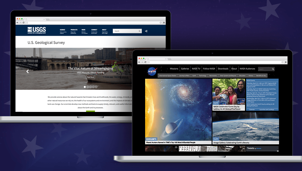
Mobomo has been working alongside many federal agencies over the years, helping to integrate the latest technologies to ensure the federal government has the most secure systems while being cost effective, saving millions each year. We are pleased to acknowledge two of our long term partners have been named as finalists and award winners for this years 2017 InnovateIT Awards. Tim Woods, Web Re-Engineering Project Lead from USGS, won the Technology Trailblazer Award and Ian Sturken, Web and Cloud Services Manager, Enterprise Application Architecture Co-Lead from NASA, was the award winner for the Mission Excellence Enabler Award.

Tim Woods, the Web Re-Engineering Project Lead, along with his team (WRET), is the visionary with a unique capability to combine deep technical understanding with executive stakeholder and business needs. He was able to work with executive leadership to define the vision and business needs of the new system, unite stakeholders and end users across multiple USGS regions and offices, and lead a user-centric design and agile software development team to deliver on a very aggressive project timeline.

The challenge faced by the US Geological Survey’s (USGS’s) Web Re-engineering Team (WRET) was to make the vast amount of scientific data and research easily accessible and searchable for the general public through an agency-wide website. This information included natural hazards, natural resources, ecosystems and the environment. The information impacts important business decisions, from infrastructure (e.g. impact of water erosion on bridges) to agriculture (e.g. predicting droughts or floods in specific locations) to hazard response and mitigation (e.g. improving ability to predict tornados, earthquakes and other natural hazards).

Previously, this information was stored in siloed databases, servers, spreadsheets and other resources, and there was no true understanding or inventory of what was available and no way for anyone outside of the agency to find or use this information. By making this information more readily available and centralized it allows citizens, industry, and other government agencies to make informed decisions about the world around them and to develop innovative solutions for preparing for potential threats and changes that impact human lives. We needed to launch the site within 6 months.

USGS WRET worked with a team of experts across the agency to develop the content, technical and mission-driven strategies for meeting this challenge. The website and CMS were built using agile methodologies, open-source software (Drupal) and hosted in an Amazon Web Services (AWS) cloud environment. USGS worked with an AWS-certified vendor that also provided Certified ScrumMasters (CSMs) for project and program management. The team launched USGS.gov in under five months, and the team continues to deploy new features in regular intervals based on USGS requirements using Scrum. An information architecture was designed to organize science information from hundreds of sources within one website and navigation system. A robust taxonomy structure allows content managers to use a “Create Once Publish Everywhere” (COPE) philosophy facilitating content distribution throughout the site.

To free up scientists to focus on science and minimize website-related tasks, the following tools were built: 1) an automated migration tool allows a new microsite to be set up rapidly by completing a simple form in the CMS and b) a custom ElasticSearch, LogStash, Kibana (ELK) module ingests data from multiple internal and external sources and can be configured within the Drupal CMS. The USGS team delivers in person and online training and maintains a training website with additional materials, updates and staff access.  

This project aligned with the agency mission and with what USGS was trying to accomplish as a whole. It provides a forward thinking approach that not only makes science provided by USGS easily accessible and searchable to the public, but also uses advanced technical solutions for keeping content updated and, in some cases, providing near real-time data for natural hazard events.

The cloud-based, Drupal framework solution has allowed multiple internal USGS departments to reduce costs on maintaining websites and data repositories that are now managed through the centralized content management system and AWS cloud infrastructure on the USGS.gov website. As additional science centers move into the new framework, those cost savings will increase.

Additionally, science centers are able to focus both funding and resources on their important research and initiatives and to more rapidly make this information accessible to the public from a central, easily searchable website. This information enables innovative solutions to problems that impact lives and livelihoods and empowers citizens to better understand the Earth and its processes from global, regional and very local perspectives.

For a complete list of award winners visit AFCEA.


Categories
Tags
Author

mobomo-named-prime-awardee-winner-by-usgs

Mobomo was recently named the winner of a prime contract at the United States Geological Survey for web re-engineering services, slated to begin this fall.

The purpose of the USGS web re-engineering project is to connect USGS research and science to Internet users through their web presence. The team will consolidate 320+ disparate websites into a single Drupal Content Management System in an Amazon Web Services cloud environment with the objective of continuously improving customer satisfaction and achieving an excellent customer experience by making USGS science and information available, usable, affordable, and accessible in one functional website.

“Mobomo is excited to have been chosen by USGS as their technical partner in this vision. The launch of the new redesigned USGS.gov was a huge accomplishment, and we look forward to continued success ensuring USGS science and information is effectively delivered to website visitors in an engaging and efficient manner.” says Ken Fang, President at Mobomo, LLC.

Mobomo, LLC, headquartered in Washington, D.C., is a premier mobile-first web and mobile application design and engineer company that has extensive experience in working with federal agencies and commercial enterprises.

Mobomo specializes in working with government agencies helping enable technologies and improve the way they serve and engage with users. Not only does this benefit the user but agencies are seeing benefit through cost savings.


Categories
Author
1
Subscribe to Usgs